Mapping the Urban Realm in Tauranga
The future of a city centre starts with a clear spatial baseline.
As Tauranga grows and intensifies, understanding how space is currently allocated across its city centre became critical. A structured spatial baseline was developed to quantify the balance between movement, parking, buildings and public space — creating a measurable reference point to guide future transformation.
What we measured.
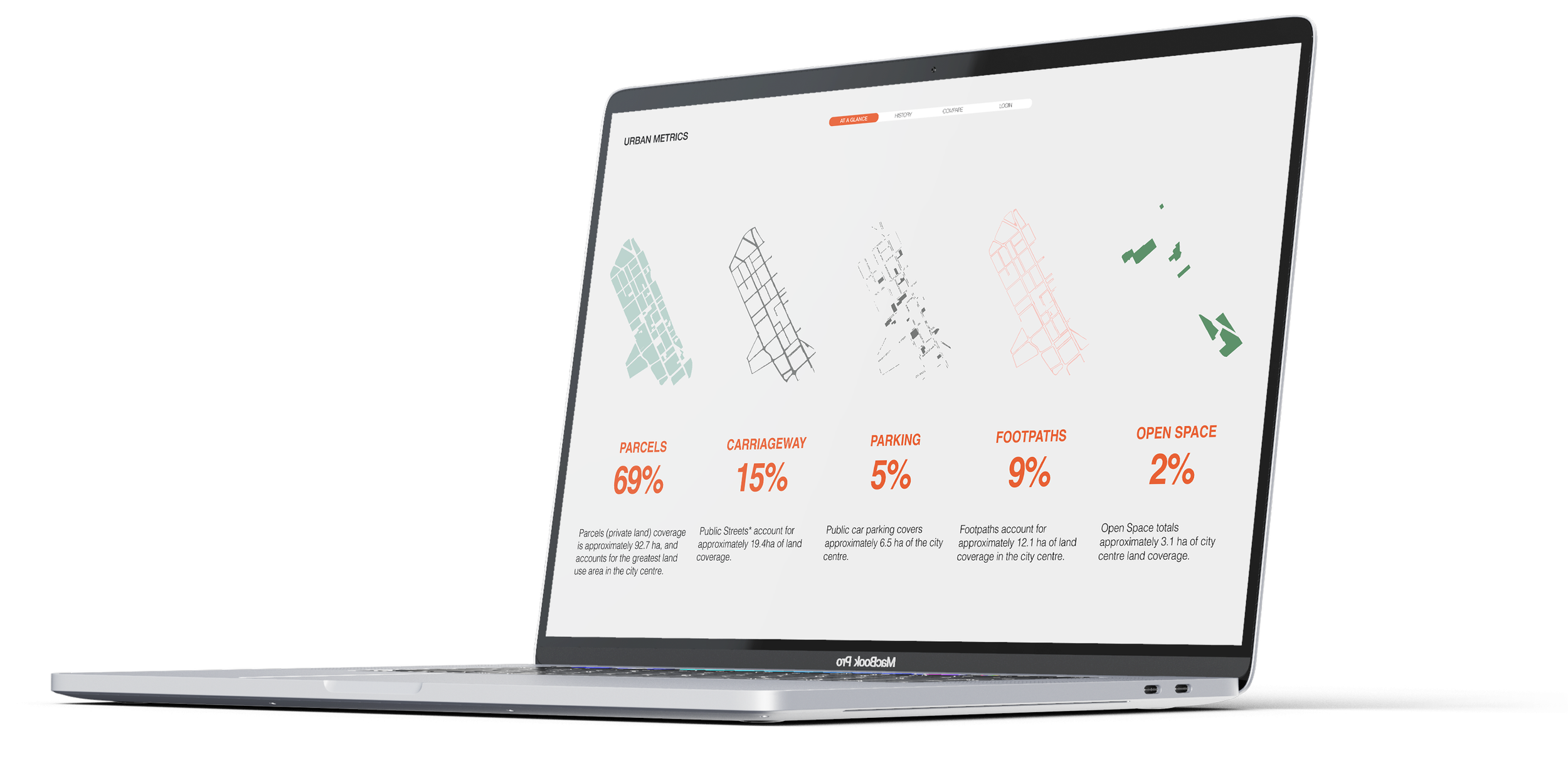
A desktop spatial analysis classified all land within the city centre into consistent, comparable categories.
This included:
Private parcels · Carriageways · Public parking · Footpaths · Open space
The method created a repeatable dataset that can be updated over time to track change and test future scenarios.
What the data revealed.
A significant proportion of land remains dedicated to vehicle movement.
Carriageways accounted for a large share of the city centre footprint, reinforcing a transport-led spatial structure.
Public open space is present — but unevenly distributed.
While open space represented a meaningful proportion of total land, much of this sat at the edge of the centre rather than embedded within everyday activity areas.
Footpath space reflects a street-edge pedestrian model.
Pedestrian movement largely occurs along transport corridors rather than within larger civic or people-focused environments.
Parking provision remains embedded in the spatial structure.
Both on- and off-street parking continue to shape how land is used and how people move through the centre.
Why it mattered.
The spatial baseline provides:
• A measurable starting point for future regeneration
• Clarity around trade-offs between movement, access and public life
• A framework for reallocating space as intensification occurs
• A tool to test how projects shift the balance between vehicles and people
The lessons are transferable to any growing city seeking to rebalance its centre toward walkability, public life and long-term resilience.